

")
")


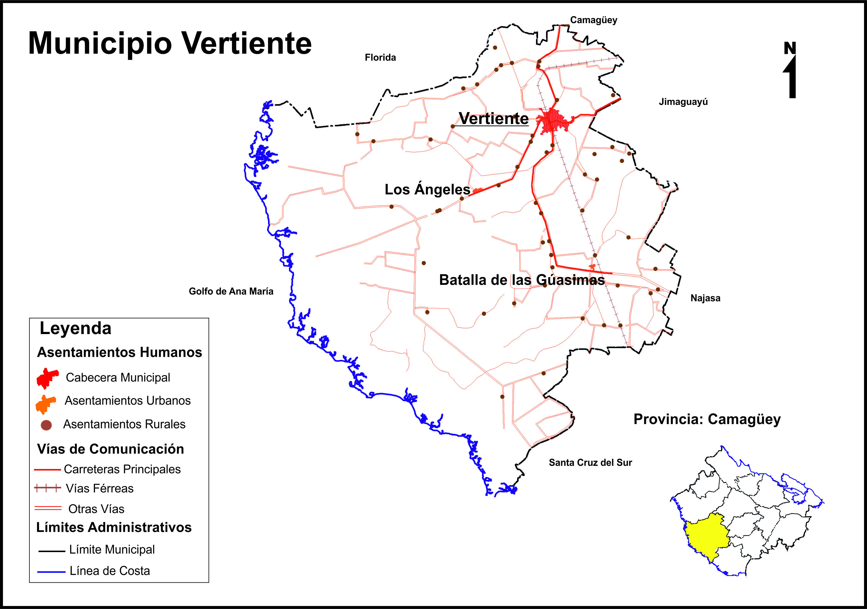
Municipality Vertientes
Centuries ago, was extending himself a plain abundant in trees and natural pasture that went up to the Southern coast of what it is today the city of Camaguey, with a territorial extension of their 2024.3km more of 80km come from low and muddy coasts, that they range from the dock of Santa María in the inlet of the same name, to the Sweet estuary of Aguas. Constitute a marine accumulative plain it descends (h: 0-5, 5-10m) with carso covered by thick deposits I sand - clayey, mossy and tubosos, toward the seashore with the lower levels, occupy a continuous flooded stripe of character marshy lacuno. In the aforementioned coast they settled down aboriginal that they lived on the marine and terrestrial collection, fishing and little mammals'hunting.
The number of huts of the Southern seaboard camagüeyano exceeds the hundred and his totality almost finds inside the territory of Vertientes. It's possible that such inhabitants, of the south of Vertientes according to realized investigations, constitute one of the most ancient migrations arawacas that got to the West Indies.
The first colonial settlements in what it is the present-day territory of springs they date themselves in 1530, when Don Vasco Porcallo of Figueroa prevailed of its investiture of captain of Guerra of the region he established a dock in Vertientes under the name of Santa María in the estuary that they were called to him until then Springs facilitating the communication of the Village with the seaboard, in order to establish coastal trade between Santiago de Cuba, Bayamo, Trinity and Batabanó.
What the municipality head is today is located in what the Group Of Domestic Animals of Jimaguayú understood, around 1800, and the name of Vertientes comes from one of the estuaries and of another neighboring group of domestic animals with the same name.
When started up in 1868, the war for the Independence of Cuba, the territory drew himself up from very active way to our independentist heroic deeds in the Stable of Jimaguayú, to initiatives of Ignacio Agramonte, gunsmith's shops and schools to train the ranks to your command militarily became established, attaining a great organization and discipline.
Within the main actions the developed army officers finds the Brigadier Julius Sanguily's Rescue, for the Major General Ignatius Agramonte the October 8, 1871 in Consuegra (in the farm The Hope).
The Mayor Ignacio Agramonte's and Loynaz's fall, the May 11, 1873 in the Stables of Jimaguayú, historic event that would mark forever the territory, being this a hard blow for the independentist motion of the country and province.
Between the 15 and March 19, 1974, the territory was second bigger Batalla's stage of America and the largest one of the war of 1868. It is the Guásimas's battle, directed for the general Máximo Gómez, where it was proven that the Liberating Army was able to establish military large-scale operations.
With the expansion of the war to the province of Camaguey and The Villages, it was becoming necessary to unite all independentist the forces and to structure juridically to the Republic in arms. With that end from 13 to September 16, 1895 the Constituent Assembly was in session in Jimaguayú and by means of the secret vote, they elected the government councilmen.
Antón, he served like concentration point of the troops mambisas, and is where he introduces himself to Gómez like Field Marshal of the Liberating Army in the War of 1895. Get the Invading Column of the Liberating Army in command of Máximo Gómez and Antonio Maceo in his parade across the territory to the west of the country, for the sake of extending the revolutionary war for all the regions of Cuba, incorporating to all the Cubans to the fight. In this way it gave the appearance of being to the world that was developing a true war of national liberation.
Due to the prosperity of the price of the sugar in the second decade of 1900 the owners of several farms set about forging an ingenuity, the today Central S.A. named Company Vertientes herself Panama. The building of the central caster in the lots of the farms Guazumal and Nueva Hope brought I get than establish himself the first family house in the batey of the future ingenuity. In 1921 it already was done the same and it begins to happen the town, between them several family houses, a hospital, barracks of the rural guard, etc. The trial sugar cane harvest that same year came true (1921). Rice begins to kill in the territory toward the years 1922 – 1923, initially limited himself in the classical sugarloaf, until years after moves in the first hulling machine.
In 1927, the Sugar Company Springs Company was located below the control of the Monopolio Yanqui Sugar, Vertientes became a territory of the imperialist company, where it did not rule more law than that of your exploitative interests, and where the common denominator was called extreme poverty, illiteracy, evacuation, unemployment and terror. In 1930 the First Peasant Association in Paso of Luke gets constituted. In 1932 the first cell of the Communist Party of Cuba founded by Mella and Baliño was created. When the Imperialist Monopoly was nationalized, the Central Vertientes exchanged the sugar laborers and the town for its name the one of Panama, like homage in general the sister Central American nation. With the revolution besides roads, roads, factories, facilities, houses, schools, doctors of the family, poly-clinicians and other works of social benefit were built. In April 1965, in your journey for the territory, our Commander In Chief and the Revolución John Almeida Bosque's Commander, as well as other leaders of the Revolution, they cut cane in Antón as a token of support to the economic development of the territory. A singular detail in the history of our municipality was the visit that makes the January 13, 1976 the nationalistic leader Panameño General Omar Torrijos, accompanied for our Commander In Chief Fidel Castro Ruz, going over the central Panama and the Polytechnic Agricultural Institute Crossing of the Narrow Path
- You should not use obscene or offensive words.
- Comments should be related to the topic.
- Comments that violate previous policies will not be posted.